Fine-Scale Strain-Rate Mapping of Japan from Integrated PublicPrivate GNSS Stations
Joint press release (in Japanese) by Tohoku University and Hokkaido University
Abstract
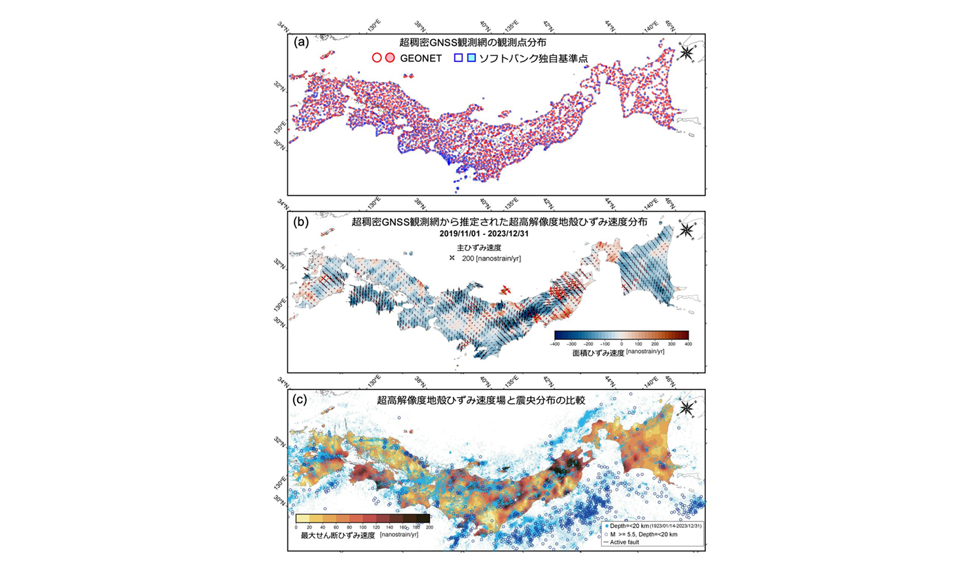
We integrated observational data from the Global Navigation Satellite System (GNSS) Earth Observation NETwork System (GEONET) in Japan, operated by the Geospatial Information Authority of Japan, with over 3,300 proprietary reference stations operated by SoftBank Corp., and, using observations from November 2019 to December 2023, estimated a nationwide interseismic strain-rate field (with postseismic contributions in some regions). We adopted an established framework that fits locally linear horizontal-velocity models with roughness-controlled spatial regularization. The degree of spatial locality (i.e., the roughness control parameter) was optimized using an L-curve. After quality control, 3,606 stations remained. In the analysis that jointly used GEONET and SoftBank data, the mean (grid-averaged) locality scale, expressed by the distance-decay constant D,….
Read more on Earth, Planets and Space
Article Information:
Miku Ohtate, Yusaku Ohta, Mako Ohzono & Hiroaki Takahashi, Fine-scale strain-rate mapping of Japan from integrated public–private GNSS stations, Earth, Planets and Space, 78, 210 (2026)
DOI:10.1186/s40623-026-02475-y